 how-to
How to Verify Property ADU Height Restrictions Step by Step
Table of Contents
- Step 1: How to Check Property Zoning for an ADU
- Step 2: Look Up Your Zoning District and Land-Use Regulations
- Step 3: ADU Height Measurement Rules Explained
- Step 4: California ADU Height Limits and State Law
- Step 5: Review ADU Site Plan Requirements and Setbacks
- Step 6: Resolve Conflicting Rules and Parcel-Specific Overlays
- Step 7: Confirm Your ADU Height Restrictions With the Planning Department
- Frequently Asked Questions
Last Updated: October 9, 2026
Step 1: How to Check Property Zoning for an ADU
ADU height restrictions are rules set by your local zoning code that limit how tall an accessory dwelling unit can be built on your property.

Before you can verify height limits, you need to know which zoning district your property sits in.
Here is how to check property zoning for an ADU:
- Find your parcel number on your property tax bill or county assessor's website
- Enter that number into your city or county planning department's online portal
- Look for a zoning map or GIS map tool
This step matters because every height rule is tied to a specific zoning district. Get the district wrong, and every number you check after this will be wrong too.
Step 2: Look Up Your Zoning District and Land-Use Regulations
Once you know your zoning district, pull the actual code section that governs it. City and county websites usually publish their municipal code online, and most include a search function.
Search for your district code plus the phrase "accessory dwelling unit." That should bring you to the development standards table for your zone.
What to look for in that table:
- Maximum height for primary structures
- Maximum height for accessory structures
- Minimum setbacks for side and rear property lines
- Maximum floor area allowed for an ADU
Many cities now have a dedicated ADU ordinance page that summarizes these rules in plain language.
Step 3: ADU Height Measurement Rules Explained
ADU height measurement is where most homeowners get confused. The number in the code means nothing until you know what it is measured from and to, and most zoning codes define that in a single sentence that is easy to skim past.
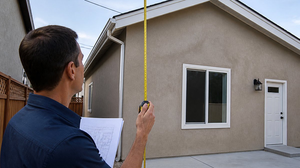
Most jurisdictions measure height from finished grade to the highest point of the roof. Finished grade is the ground level after all grading and landscaping is complete, not the dirt level you see today.
Key measurement terms:
- Grade: The ground surface elevation at the building perimeter
- Finished grade: Ground level after final grading, before landscaping
- Average grade: The mean elevation of the ground at the building corners, used by many codes instead of the highest point
- Roof peak: The highest point of the roof structure
How to Actually Take the Measurement
A genuinely step-by-step method for verifying height on a specific parcel looks like this:
- Pull the survey or site plan for your parcel. If you do not have one, your county assessor or recorder's office usually has a recorded plat or parcel map you can download.
- Identify the building footprint of the proposed ADU on that plan, including any covered porches or attached garages that count toward the structure.
- Mark the four corners of the footprint and note the existing ground elevation at each one.
- Estimate finished grade at each corner by adding the depth of any planned fill or subtracting planned cut. If you are not regrading, existing grade is your finished grade.
- Determine which grade point the code uses. Search the code for the definition of "building height" and look for the words "highest," "average," or "lowest" adjacent to grade. This single word changes your allowable height by feet, not inches.
- Measure vertically from that grade point to the reference point the code specifies, roof peak, mid-roof, or plate height.
- Add any projections the code counts, such as chimneys, cupolas, or parapets, and subtract any the code exempts, such as eaves within a stated overhang distance.
Sloped Lots and Raised Foundations
On a lot with more than a few feet of fall, the choice between highest grade and average grade can swing your allowable height by three to five feet, often the difference between a compliant one-story design and a redesign.
A common pattern is for homeowners to measure from the lowest point on the lot, assume that is grade, and then discover during plan review that the jurisdiction measures from the highest adjacent grade.
If you measure from the wrong grade point, your plans can fail plan review. That means resubmittal fees and weeks of delay. Confirm the measurement method in writing before you design.
Ask the planner one specific question: "For a building on this parcel, is height measured from the highest adjacent grade, the lowest, or the average, and is it measured to the roof peak, mid-roof, or plate height?" A one-line email answer resolves most measurement disputes before they start.
Height is not a single number. It is a measurement method. Get the method wrong and every subsequent calculation is wrong too.
Step 4: California ADU Height Limits and State Law
California has some of the most homeowner-friendly ADU rules in the country. State law sets a floor that local ordinances cannot go below.
Under state law, a detached ADU generally may not be limited to less than 16 feet in height.
Local rules can be stricter in some cases.
California's Department of Housing and Community Development ADU guidance publishes plain-language summaries of these rules.
| ADU Type | State Minimum Height Allowed | Common Local Range |
|---|---|---|
| Detached | 16 feet | 16-20 feet |
| Attached | 25 feet | 25-30 feet |
| Junior ADU | Varies by city | 16-20 feet |
Step 5: Review ADU Site Plan Requirements and Setbacks
ADU site plan requirements usually include a scaled drawing showing your lot lines, existing structures, the proposed ADU, and all setbacks.
Setbacks affect height in a practical way. A taller ADU placed close to a property line may trigger additional review or be denied outright.
Common setback rules to check:
- Rear setback: often 4 feet for detached ADUs in California
- Side setback: often 4 feet, but can be larger on corner lots
- Front setback: usually matches the primary home
- Fire separation: may require more distance if the ADU is near a structure
Buildable area shrinks fast once setbacks are applied. On a tight lot, a taller, narrower design often works better than a wide, short one.
Step 6: Resolve Conflicting Rules and Parcel-Specific Overlays
Conflicts happen more often than people expect. The state law says one thing, the city code says another, and your parcel has an overlay that says something else entirely. The skill is not memorizing the rules, it is knowing which rule controls when they disagree.
The Order of Authority
When two sources give different height limits, work through them in this order:
- Parcel-specific conditions, recorded easements, deed restrictions, or conditions of approval from a prior permit. These bind your specific lot regardless of what the code says generally.
- Overlay districts, historic, coastal, hillside, transit priority, flood, and fire severity zones. Overlays sit on top of base zoning and typically tighten, not loosen, height limits.
- Base zoning district, the R-1, R-2, or other district code you identified in Step 1.
- State ADU law, sets a floor that local ordinances generally cannot go below, but with carve-outs for specific overlay types.
- General plan and design guidelines, rarely set a numeric height, but can drive design review conditions that effectively cap height.
How to Read a GIS Overlay Layer
County and city GIS portals typically stack layers you can toggle on and off. Turn on the base zoning layer first, then add each overlay layer one at a time and note which ones intersect your parcel boundary, not just your neighborhood.
Record every layer that touches your parcel, even ones that seem irrelevant. Flood and fire severity overlays rarely change height directly, but they can trigger additional review that adds conditions.
When State Law and Local Code Disagree
State ADU statutes generally preempt local ordinances that are more restrictive than the state floor, but the preemption is not absolute. Common carve-outs include:
- Properties within a designated historic district
- Properties within a coastal zone subject to a certified local coastal program
- Properties where the ADU would exceed the height of the primary dwelling
- Properties with recorded deed restrictions or homeowner association covenants that predate the state law
If your parcel falls into one of those carve-outs, the local limit likely controls. If it does not, the state floor likely controls, but you still need the local jurisdiction to agree in writing before you rely on it.
What to Do When Sources Disagree
A practical workflow:
- Screenshot every source you relied on, with the URL and the date you accessed it. Codes change.
- Write a one-paragraph summary of the conflict: what the state says, what the city says, what the overlay says, and which one you believe controls and why.
- Submit that summary to the planning department through their general inquiry email or counter appointment, and ask for a written determination.
- If the counter answer conflicts with the code, ask the planner to cite the specific code section they are relying on. If they cannot, escalate to a supervisor or request a written zoning verification letter.
- Keep the response in your project file alongside your site plan and survey.
Many planning departments publish a formal zoning verification letter service, sometimes for a modest fee, that puts the department's interpretation in writing. For a project where the height limit is close to your design, that letter is often worth more than the fee.
Verbal guidance from a counter planner is not binding on the jurisdiction. Staff rotate, interpretations shift, and a later reviewer is not obligated to honor what you were told at the window. Get it in writing.
The rule that controls is not always the one that is easiest to find. Work the order of authority, document every source, and convert verbal answers into written ones before you commit to a design.
Step 7: Confirm Your ADU Height Restrictions With the Planning Department
A written confirmation from your planning department is the only reliable way to lock in your ADU height restrictions. Verbal answers change.
What to include in your request:
- Your parcel number and address
- Your zoning district and any overlays
- The ADU type you plan to build
- The height you intend to build to
Ask for a written response, even if it is just an email. Keep it with your project file.
At QuiPlans, our PE-stamped drawings are prepared by licensed structural engineers in 26 U.S. states, so your plans arrive ready for the permit desk.
Frequently Asked Questions
How is ADU height measured?
ADU height measurement rules vary by jurisdiction, but most measure from finished grade at the lowest point of the structure to the highest point of the roof. Some cities measure to the roof peak, while others measure to the average roof height. Eaves and parapets may or may not be included. Always check your local planning department's definition of building height before finalizing your design, because a few feet of difference can determine whether your ADU complies with local ADU height restrictions.
Can local rules limit ADU height beyond state requirements?
Yes. State law sets baseline protections, but local zoning can impose stricter limits in certain zones or for specific lot conditions. For example, a city may allow 16 feet in a standard residential zone but cap height at 12 feet in a historic overlay or hillside district. Local rules can also reduce height if your ADU is within a certain distance of a rear property line. Always verify both state and local ADU height restrictions for your parcel.
What should I do if my proposed ADU exceeds the height limit?
First, confirm the exact measurement method your city uses. Sometimes a design that appears too tall under one method complies under another. If your ADU genuinely exceeds the limit, you have options: lower the roof pitch, switch from a two-story to a single-story design, apply for a variance or height exception, or relocate the ADU on the lot. Exploring design alternatives with a professional can help keep your project within ADU height restrictions.
What documents should I bring to a planning department when checking ADU height?
Bring your property's APN or address, a current site plan showing property boundaries and existing structures, a preliminary ADU floor plan with proposed dimensions, and any zoning or overlay information you have already gathered. If you have a survey, bring it. Planning staff can then confirm your zoning district, applicable ADU height restrictions, setback requirements, and any parcel-specific overlays that affect your buildable area.
Verifying height rules takes patience, but it protects your budget and your timeline. QuiPlans supports homeowners with permit-ready ADU floor plans, PE-stamped engineering drawings, and feasibility studies that flag height and setback issues before you submit. Trusted by more than 7,000 homeowners, we help you move from concept to construction with confidence. Get started with QuiPlans and submit your ADU permit with plans built to pass review.